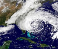
Real-time forecast of Hurricane Sandy had track and intensity accuracy
By A'ndrea Elyse Messer February 25, 2014
This system can also identify the sources of forecast uncertainty.
"For this particular study aircraft-based Doppler radar information was ingested into the system," said Fuqing Zhang, professor of meteorology, Penn State. "Our predictions were comparable to or better than those made by operational global models."
Zhang and Erin B. Munsell, graduate student in meteorology, used The Pennsylvania State University real-time convection-permitting hurricane analysis and forecasting system (WRF-EnKF) to analyze Hurricane Sandy. While Sandy made landfall on the New Jersey coast on the evening of Oct. 29, 2012, the analysis and forecast system began tracking on Oct. 21 and the Doppler radar data analyzed covers Oct. 26 through 28.

