Meteorologists Track Wildfires Using Satellite Smoke Images

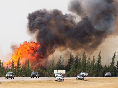
Evacuees flee a wildfire that threatened Fort McMurray, Alberta, Canada, in May 2016. Forecasters used this fire to test the capabilities of a new fire and smoke data resource from NOAA. Credit: Jonathan Hayward/The Canadian Press via APBy
Wildfires and controlled burns place special demands on the people who decide where and when to deploy firefighters, how to keep controlled burns contained, and how best to protect life and property. Meteorologists from the National Weather Service weather offices, fire incident meteorologists, and state and local air quality forecasters provide information that is vital to assisting these decision makers. These meteorologists must determine the effects of smoke and quickly incorporate them into their forecasts related to visibility and air quality.Read the full article here:
Meteorologists Track Wildfires Using Satellite Smoke Images
